How to benefit from high-resolution digital elevation models to simulate partial beam blockage?
$K.Muehlbauer^{1}$ (kai.muehlbauer@uni-bonn.de), $M.Heistermann^{2}$
- $^{1}$ University of Bonn, Germany
- $^{2}$ University of Potsdam, Germany

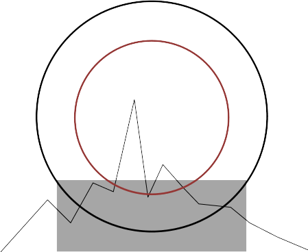
| Bech et.al. (2003) | Cremonini et.al. (2016) |
|---|---|
 |
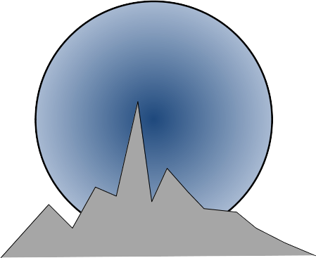 |
| * Interpolate DEM to obtain only one representative terrain altitude per bin | * Consider terrain profile over beam cross section by digitizing over point cloud |
| * Consideration of energy distribution via half-power beam radius | * Consideration of energy distribution via Gaussian antenna pattern |
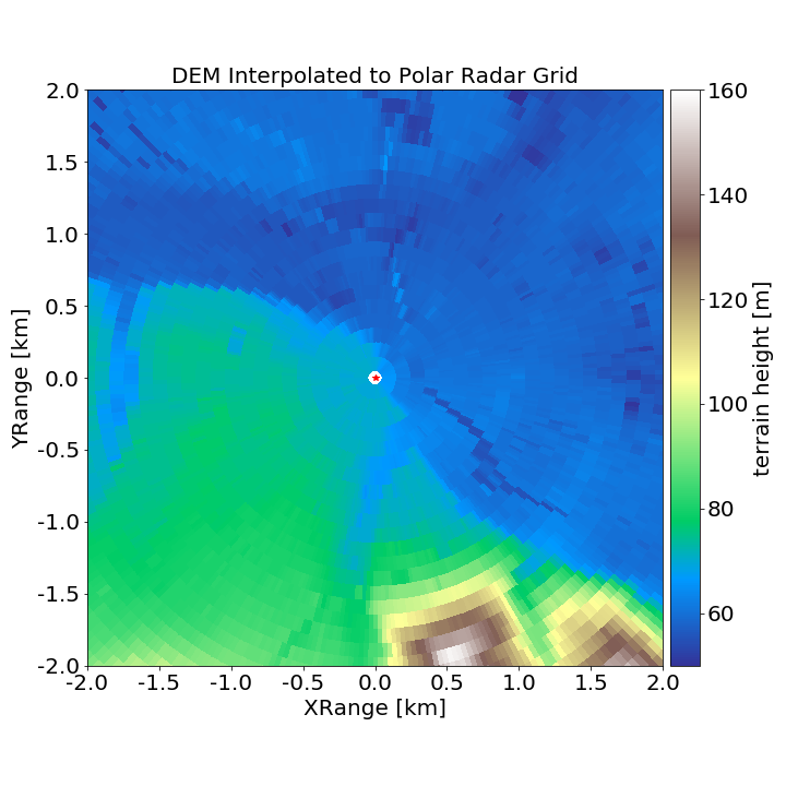
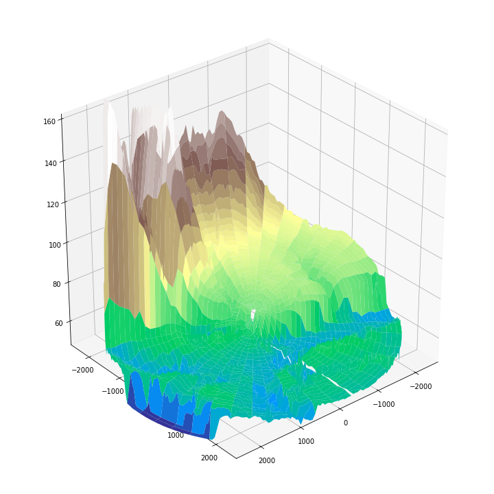
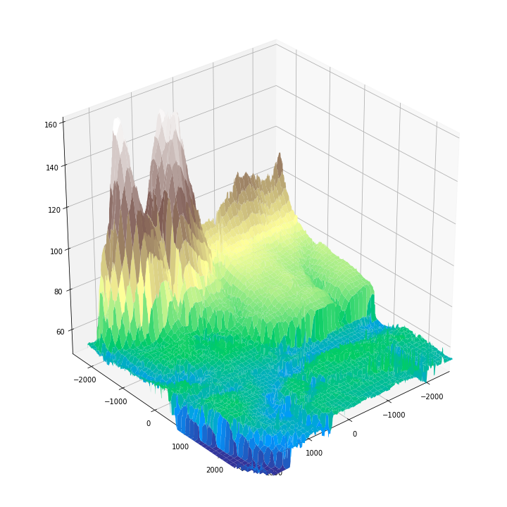
Comparison of interpolated DEM in polar coordinates with Hi-resolution DEM
| Interpolated DEM | Hi-resolution DEM |
|---|---|
 |
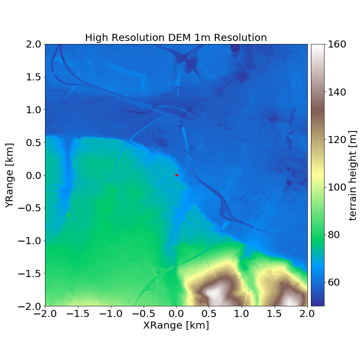 |
| Interpolated DEM | Hi-Res DEM |
|---|---|
 |
 |
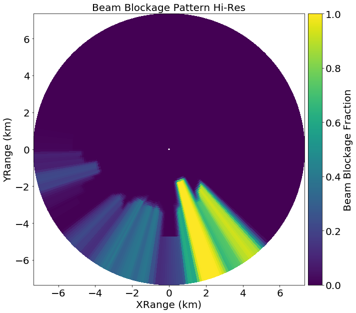
Hi-Resolution DEM Approach
- The intuitive approach is to take into account the terrain variation within the sampling volume.
- Doing so requires to take also the beam energy distribution into account.
- To match the terrain with the radar beam we translate the DEM coordinates into the radar's spherical coordinate system.
- Already possible using standard wradlib georeferencing functions.
Workflow
- Create radar coordinates in spherical coordinate system
- Translate DEM to the same spherical coordinate system
- Collect all DEM points in the different radar range intervals
- Resample all DEM elevation values within one range interval onto the same high resolution azimuth grid
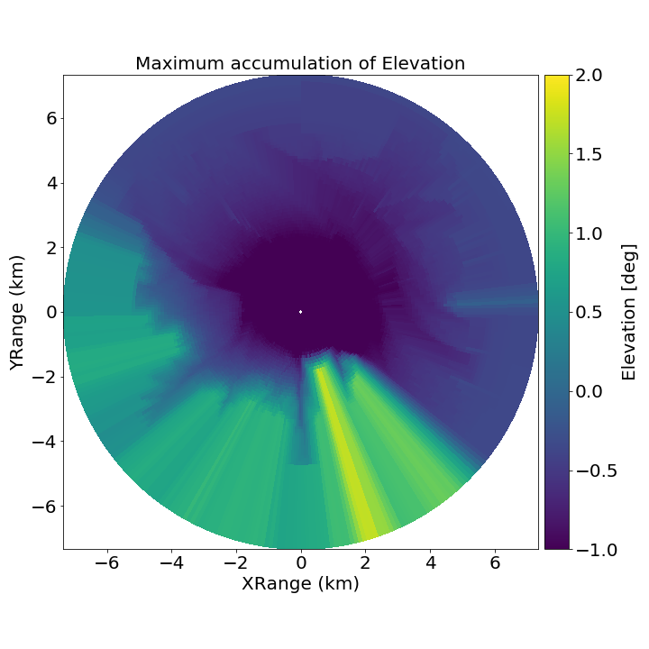
- Calculate cumulative maximum of elevation along range
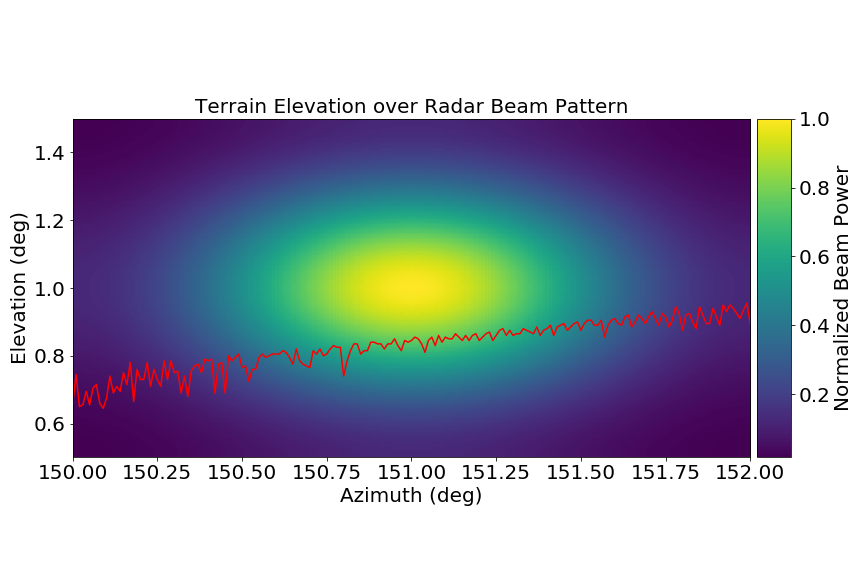
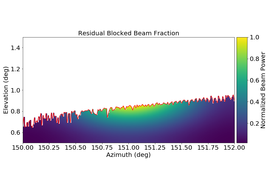
- Iterate over antenna pointing angles and match gaussian beam with elevation to calculate blocked energy ratio
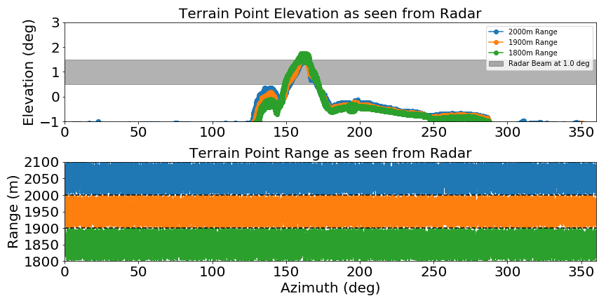
Diagnostic Plot for 3 ranges
Diagnostic Plot for 4 ranges
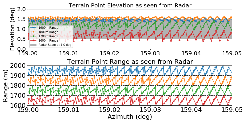
Terrain height over gaussian beam pattern
Blocked beam fraction
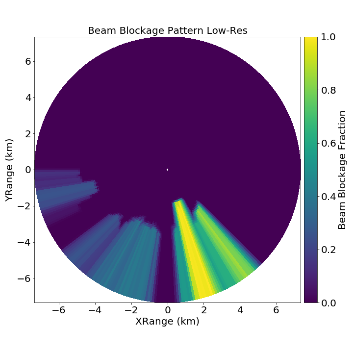
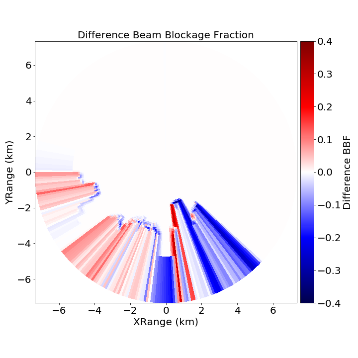
Preliminary Results
Outlook
- Apply the method with a radar with a more interseting near field (towers and scyscrapers).
- Disentangle effects of DEM resolution, interpolation and beam pattern.
- Work in progress code repository is available under github and will finally be integrated into wradlib codebase.
Acknowledgments
Alper Çubuk and Kurtuluş Öztürk 
High Resolution DGM1 Data (1mx1m) 

 |
|||
 |
 |